Tuesday, December 31, 2013

McDowell Sonoran Preserve

Entering the park in north Scottsdale

Last Wednesday, I took my 5th annual Christmas Day hike. This year I went to the McDowell Sonoran Preserve in north Scottsdale. I took the Gateway Loop trail, which was a little over 3.5 miles and took me about 1 hour and 45 minutes. The weather was sunny with temperatures in the low to mid 40s.

I went clockwise on the loop trail, which took me on the north side of a peak, so the first half of the hike was shaded. It was a gradual rise in elevation until I reached the Gateway Saddle on the east end of the loop. From there, it was downhill and on the sunny, south side of the peak. I started the hike a little before 8am, so I didn't run into too many people until the last mile of the hike.


The all-important topo map

Let's take a walk

A beautiful morning for a hike

Hmmmm…let's go clockwise

Cholla cacti

Morning sun peeking over the McDowell Mtns.

Drinkwater Peak off in the distance

Expecting The Thing to emerge

Half-way home.

Warm sun on the south side of the loop

Almost back to the trailhead

Phoenix Mtns in the distance.

Back at the trailhead

Not 10, not 15…13

Monday, September 30, 2013

Snow Canyon State Park

Entering the park

Last Thursday, I took my 4th annual pilgrimage to Springdale, UT for the Zion Canyon Music Festival.
Unlike the last three years, I didn't take any pics or video of the festival itself. I just relaxed with the other festival-goers and enjoyed the music and great weather. (Here's my festival review: The Rainbow Girls rocked it!) Instead, on Friday, I took a day-trip over to 
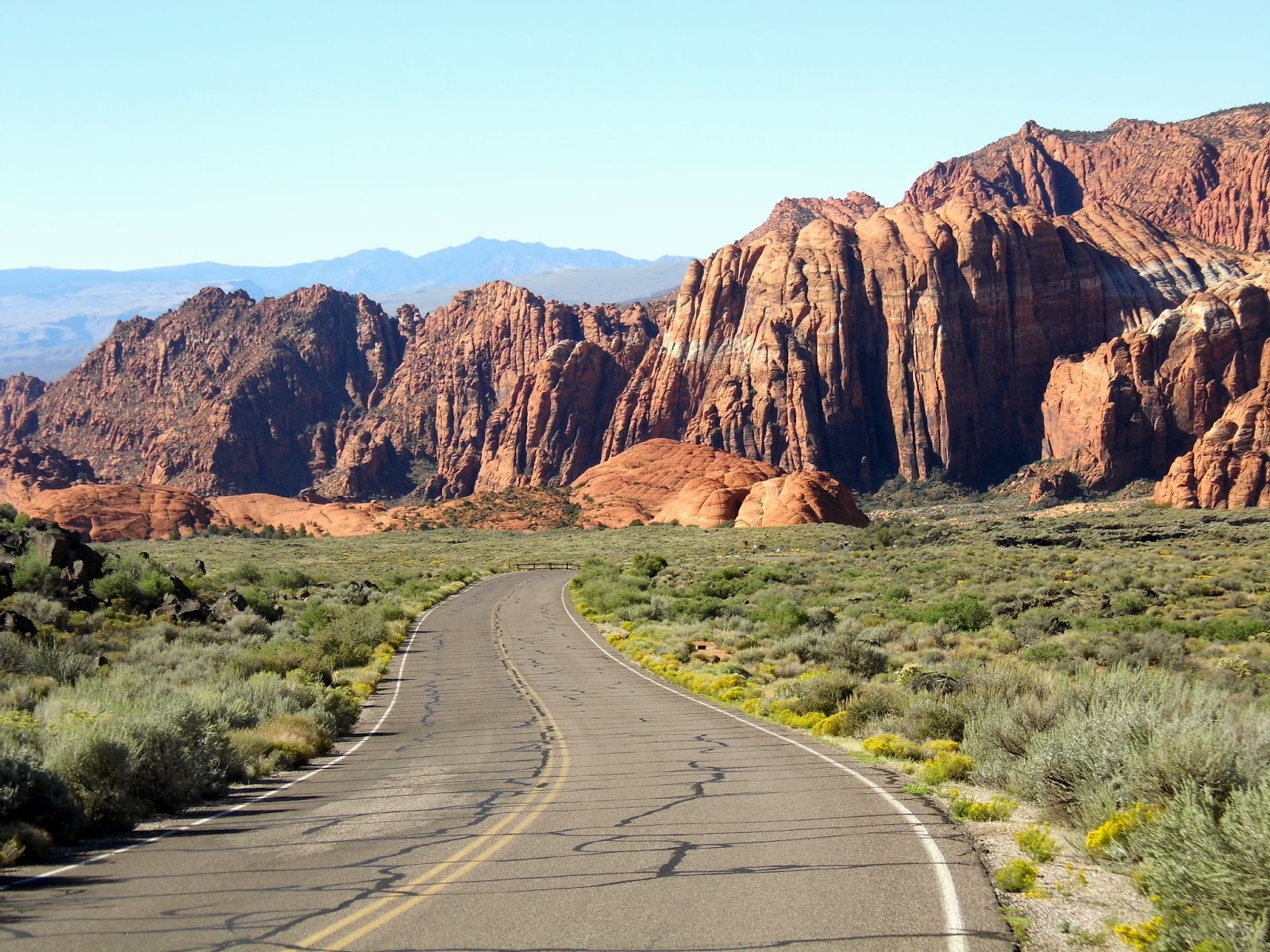
Snow Canyon State Park, which is 8 miles north of St. George.

Snow Canyon is a Navajo sandstone canyon with a bottom filled with a lava flow. Most of the lava tubes have long since collapsed, but a couple remain that can be negotiated. I didn't have a flash light, so no lava tube excursion for me. According to the park brochure, Snow Canyon is situated at the intersection of the Colorado Plateau, Great Basin, and Mojave Desert, which gives it a diverse mix of plant and animal life, including the desert tortoise. The park is quiet and colorful.


Visitors on the dunes

Undulating

Wall with arch

Looking north from the park road

Looking south from the park road

Rock and sage

Looking west from an overlook

I have no idea...

Lava and sage

Entrance to a lava tube

Color Country

Exiting the park

Monday, May 27, 2013

Alamo Lake State Park


Yesterday, I took a day trip to Alamo Lake State Park, which is about 2 hours northwest of Phoenix. This is a man-made lake from the damming of the Bill Williams River, just below the confluence of the Big Sandy and Santa Maria Rivers.

This is a pretty small park with the outdoor activity limited to camping and water sports. There are no established hiking trails, so I was confined to the three park roads. After driving all three roads and stopping at various viewpoints, I then drove back and forth on Alamo Dam Road hoping to catch a glimpse of some wild burros, remnants of long-ago Arizona mining days. Judging from all the piles of poo on the roads, there must be a lot of them. Arriving at the park mid-day, animal activity was pretty low.

I have to admit, this is one of the lamer day trips I've ever taken, but at least I got out of town for the better part of the day.

Boaters, swimmers, and fishermen enjoying the lake

Artillery Peak 

Dam metrics

View of dam from the Bill Williams Overlook

Desert blends into water

View from Alamo Dam Rd.

Cholla Rd. boat ramp

Backwater

The ass end of a wild burro

Orchard in Wenden, AZ