Tuesday, September 30, 2014

Utah Rt. 14


To get to Cedar Breaks (previous post) I took Utah Rt. 14 out of Cedar City to the east. The road winds through Cedar Canyon before topping out on the Markagunt Plateau. Half-way from Cedar City to Utah Rt. 89, there's a turn off that leads to Cedar Breaks. As you proceed east past the turn off, you drive across a sub-alpine meadow. You then skirt Navajo Lake, which was formed by a creek that was dammed by a blocky lava flow referred to as the Black Rock Desert.

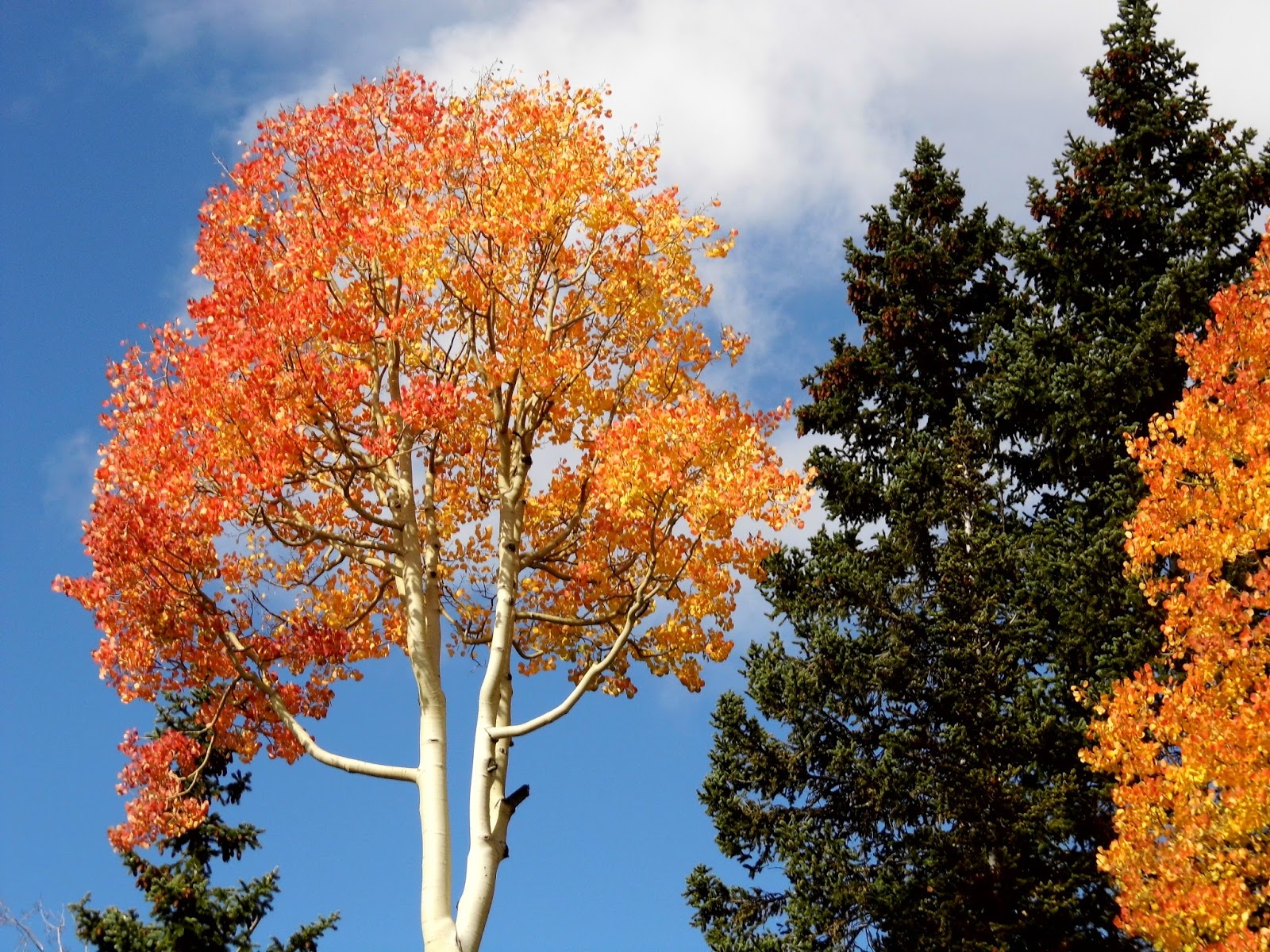
The air on the plateau was brisk and refreshing and the aspen were changing colors. It was a nice break from life in the northern Sonoran Desert.


Friday, September 26, 2014

Cedar Breaks National Monument


I'm in Springdale, UT for the 6th annual Zion Canyon Music Festival. This morning, I decided to take a  day trip to Cedar Breaks. Cedar Breaks is a natural rock amphitheater over 2000' deep and over 3 miles wide.

I can't describe the photos, so I won't bother with captions. Just know that it's an inhospitable place with rock spires, clefts, rifts, and other geological nonsense and chicanery.

The sky was filled with fast-moving, broken clouds, so the light/shadow was constantly changing.


View from the Ramparts Trail:


View from Point Supreme Overlook:


View from Sunset View Overlook:


Tuesday, February 18, 2014

Lost Dutchman State Park


Yesterday, I drove 40 miles east of Phoenix to Lost Dutchman State Park, which sits at the base of the Superstition Mountains. I decided to take the Siphon Draw Trail up to the Basin. The trail starts in the state park and then crosses into National Forest land.

Metrics:

Distance: 4 miles roundtrip
Trailhead elevation: 2080'
Basin elevation: 3100'
Ascent time: 1 hour, 15 minutes
Descent time: 1 hour 5 minutes
Weather: low 60s and clear at 8 am
Level of Difficulty: strenuous

This was a tough hike. It started as a gradual upslope and got steeper as you got closer to the Basin. The Basin is a narrow chute of slick rock at the top of the draw. The established, maintained trail stops at the bottom of the Basin. If you want to continue up to the top at 4800', you have to follow a well-worn social trail. I hiked just above the Basin and called it good.


Tuesday, December 31, 2013

McDowell Sonoran Preserve

Entering the park in north Scottsdale

Last Wednesday, I took my 5th annual Christmas Day hike. This year I went to the McDowell Sonoran Preserve in north Scottsdale. I took the Gateway Loop trail, which was a little over 3.5 miles and took me about 1 hour and 45 minutes. The weather was sunny with temperatures in the low to mid 40s.

I went clockwise on the loop trail, which took me on the north side of a peak, so the first half of the hike was shaded. It was a gradual rise in elevation until I reached the Gateway Saddle on the east end of the loop. From there, it was downhill and on the sunny, south side of the peak. I started the hike a little before 8am, so I didn't run into too many people until the last mile of the hike.


The all-important topo map

Let's take a walk

A beautiful morning for a hike

Hmmmm…let's go clockwise

Cholla cacti

Morning sun peeking over the McDowell Mtns.

Drinkwater Peak off in the distance

Expecting The Thing to emerge

Half-way home.

Warm sun on the south side of the loop

Almost back to the trailhead

Phoenix Mtns in the distance.

Back at the trailhead

Not 10, not 15…13