Monday, December 26, 2011

South Mountain


Arriving at the Holbert Trail
Yesterday was my third annual Christmas Day hike. This year I went to South Mountain to hike up to Dobbins Lookout, which is the highest point in the park accessible by trail. (See here for my 2009 and 2010 hikes) To get to Dobbins Lookout, you follow the Holbert trail almost to it's terminus, where you take a spur trail to Dobbins.

It's been a chilly December this year compared to last; the temperature at the start of the hike was 40ยบ, compared to mid-50s last year.

Metrics:

Round trip distance: approx. 4.8 miles
Elevation change: approx. 1100'
Ascent time: 48 min.
Ascent pace: 3.00 mph
Descent time: 43 min.
Descent pace: 3.35 mph
Footwear: Vibram Five Fingers
Water consumed: approx. 20 oz.

Thoughts:

This trail surface was much rougher and more rugged than my previous hike in Zion. Coupled with the chilly temperatures, my feet got a good workout in the Vibrams. Also, overall, this trail was a bit steeper, so it provided a good workout, but a slower pace. Being on the north side of the mountain, most of the hike was in the shade, so it was nice to get to the top and bask in the sun.


Let's get going

Piece of cake

Rocky slope forming one side of a ravine

Sun peeking over South Mountain

Downtown Phoenix in the distance

Approaching the ridge line and the morning sun

I took the spur trail to Dobbins Lookout

Success

The Valley of the Sun from Dobbins Lookout

Dobbins Lookout shelter

Looking west from the shelter

Looking north from the shelter

Looking northeast from the shelter

Back at the trail head

Lunch at Lux after a 4.8 mile hike and a 17-hour fast: egg bake with broccoli, cheddar and onions; bacon; sourdough toast; corn muffin; and coffee

Monday, September 26, 2011

2011 Zion Canyon Music Festival

3rd Annual Music Fest

Pressed Into Duty

A beautiful DeArmond Guitar
The 2nd act on Friday night was Shannon McNally and the Smoke Signals. She and her band left later that night to continue their tour. On Saturday night I arrived at the music fest and ran into Alex, the event coordinator. The following is the gist of our conversation:

Alex: Dave, when do you go back to Phoenix?
Me: Tomorrow morning.
Alex: Can you do me a huge favor?
Me: Sure.
Alex: Shannon McNally left last night and forgot a $2,000 guitar. She needs it for a show in Tempe tomorrow night. Can you get it to her?
Me: You got it.

Her band was playing at the Sail Inn in Tempe at 8:30, near ASU, and I delivered the guitar at 4:00 p.m. Mission accomplished. (Do NOT say like GW)

Hike to Scout's Lookout

Crossing the Virgin River at the Grotto Trailhead
 On Saturday morning, I took the Zion National Park shuttle to the Grotto to hike up to Scout's Lookout. From Scout's Lookout, hikers can continue on to Angels Landing or the West Rim Trail. I'd like to say that I did this hike to commune with nature and be in the Great Outdoors, but I really did it to push myself and gauge my current level of fitness and conditioning. And just to add another element, I did the hike fasted. (hadn't eaten in over 12 hours) I left the trailhead at 10:00 a.m., so the hike was still mostly shaded and the down canyon breeze still plugging along.

Metrics:

Roundtrip distance: 3.9 miles
Elevation change: 1070 feet
Ascent time: 38 minutes
Ascent pace: 3.08 mph
Descent time: 34 minutes
Descent pace: 3.44 mph
Footwear: Vibram Five Fingers
Water consumed: 24 ounces

Thoughts:

While this is a spectacular hike and I've done it numerous times, I've always dreaded it, because it would beat me up. I have to admit that I destroyed this hike this time and I'll tell you why. First, I didn't take my first water break until the base of Walter's Wiggles. Usually, I've had 3 or 4 by this time. My second water break was at the top of Walter's Wiggles and a third at Scout's Lookout. I didn't have any more water until I got back to the trailhead. I got through the entire hike on only 24 ounces of water. Second, I was easily passing other hikers on the ascent when it's usually me giving way to let someone pass. Third, my ascent time was very close to my descent time and I was not lollygaggin' on the way down. Fourth, I buzzed up Walter's Wiggles in virtually no time, a first for me. All in all, very happy with my current level of fitness.

The trail surface varies between sand, gravel, rough-textured concrete and rock. My Vibrams performed like a champ. At the end of the hike, I had one hot spot on my left heel from the descent. Can't ask for more than that.


I love the "falling to your gruesome death" icon

Angels Landing

Mid-morning in the canyon

Sandbar in the Virgin River

Looking down canyon just before entering Refrigerator Canyon

Refrigerator Canyon

Base of Walter's Wiggles, a series of 21 switchbacks

At the top of Walter's Wiggles, taunting the namesake for his feeble attempt at slowing my ascent

Looking down from Scout's Lookout

Hikers continuing to Angels Landing

Angels Landing to the right, viewed from Scout's Lookout

Exiting Refrigerator Canyon on the descent

Back at the trailhead

Post-hike, post-fast lunch - rice bowl with teriyaki chicken and veggies

The Road Less Traveled

Taking a shortcut


 In the spirit of this blog, I took a shortcut. After 6.5 hours of driving, I was on Rt. 59 in Apple Valley Utah about 8 miles from the UT/AZ border. To get to Springdale, UT from this point, you can continue on Rt. 59 to Hurricane, UT and backtrack about 25 miles on Rt. 9. Or, you can cut across Smithsonian Butte to Rt. 9 in Rockville, UT, which is about 7 miles. Then, it's just about a mile to Springdale. It was slow-going on the dirt/gravel road, but very scenic.


About 7 miles across the butte

The West Temple

Strata

East Temple at the far left

A rocky, sandy gulch

Descent of the butte towards Rockville

Almost to Rt. 9

Crossing the Virgin River in Rockville

Monday, August 22, 2011

Quebec City, Quebec

Crossing the St. Lawrence River into Quebec City

A recent 2 week vacation to New England included a 4 day trip from Portland, ME to Quebec City. My brother, Jeff, flew into Portland and we rented a car for the 5.5 hour drive to Quebec. The twins, Mike and Matt, drove up from Alexandria to meet us. We stayed at a hostel in the The Old City that had 4 beds and a private bath. We spent about 2.5 days sightseeing around The Old City, The Lower City and the area just west of the Old City. It's a beautiful city and I highly recommend visiting, if you get the chance. We also decided that we didn't have a bad meal the entire time we were there.

Recommendations:

Lodging - Auberge Internationale

Food - Cafe Le Hobbit and Chino Sois

Most Pretentious Club - Chez Maurice

Favorite Eccentric - Female Nick Nolte at the hostel

Favorite Pic - the fire escape in The Lower City

Side trip - Montmorency Falls (see post below)

Footwear - Vibram Five Fingers (mine were awesome. wore them 4 straight days)


The Old City


The Lower City


Battlefield Park


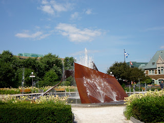
Fountains and Statues